Advance with Assist shares quick solutions to common challenges encountered by the InterWorks Assist on-demand team.
Question: I am not interested in seeing the landmass around the US. Is there a way to get rid of it within Tableau?
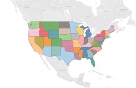
As with most questions posed to the Assist team, the answer is yes. The end result you want just requires a bit of formatting or going through a few steps. Let’s start with a map by state. You can now see the landmass that the user was wanting to eliminate:

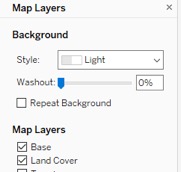
We can now go into the Map Layers menu. Since a filled map is used, the Background map Washout can be increased to 100% in order to eliminate the landmass:

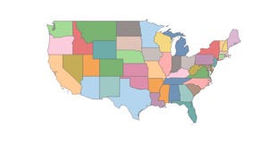
We now no longer see the landmass as the client desired. That’s the simple solution, but let’s take it a step further:

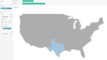
Let’s consider that you want to bring attention to the state of Texas. Would you want your map to only display Texas or include the whole US outline while simply highlighting Texas?

By creating a dual-axis map where you have only state displayed on one of your Marks cards, you can then filter to a state and keep the country outline as desired:

If you’re interested in diving deeper into these concepts, my colleague Will Jones has authored a blog with more details regarding dual-axis maps and coloring.

