As someone who loves history, Boston was a great place to grow up. With everything from colonial gems like the Old State House and Faneuil Hall to cultural landmarks like Fenway Park and the Boston Common, the city is full of historic sites.
Unfortunately, there are some drawbacks to all that history. Instead of an easy-to-navigate grid, the city exists as a web of streets so confounding that locals speculate it was designed by wandering cows. One-way streets, dead ends and seemingly hidden entrances to the Mass Pike are enough to drive an unfamiliar visitor crazy.
It’s probably why most end up spending their money on one of the many high-priced parking garages and opting for a free tour of the city courtesy of a painted red line. Nothing against the Freedom Trail, but it almost always ends with “Hey look, it’s Cheers!” and well – let’s just say there’s a reason Norm and Cliff stuck to beer. Fortunately, we have the world’s best solution to the problem – data!
Creating a Guide with Open Data, Alteryx and Tableau
The excellent Analyze Boston site has data on historic landmarks, public parking and restaurants all available for free download. Just like Barbara Lynch with a pile of farm fresh ingredients, we at InterWorks knew just what to do. Leveraging Alteryx’s spatial analysis tools and Tableau’s mapping capabilities, we put together a guide to Boston’s historic sites – highlighting the best nearby restaurants and closest public parking options – aimed at ensuring you experience Boston’s rich history while avoiding its most common frustrations.
Dashboard Tips
While we think the dashboard is relatively intuitive, here are a few tips to help you get the most out of it:
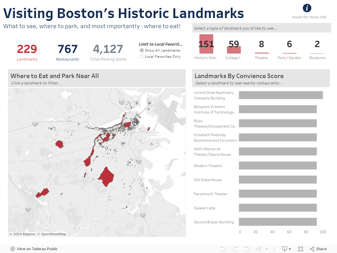
- Boston is historic – like, extremely historic – and while it’s possible seeing the sidewalk clock at 9 Chelsea Street is at the top of your list of sites, you may want to use the “Limit to Local Favorites” option to narrow in on our top picks.
- In the bar chart on the right, landmarks are ranked by “Convenience Score” – a highly complex and proprietary algorithm (insert sarcasm notation here) denoting the concentration of parking and restaurant options nearby.
- Selecting a landmark from either the map or the bar chart will expose a list of restaurants and their distance to the selected landmark. Selecting a restaurant from the list will provide a menu option with a URL link to a web search of the restaurant.